
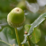
In Apidia, within the municipality of Kallifoni, the surrounding environment features forests cedar, oak and fir. The woods are dotted by innumerable springs. The landscape is one of especial beauty. The Kalentzis River, a tributary to the Pineus, has its source within the district. There are mineral springs a short distance upstream of the old bridge of Kanaviotiko at an altitude of 400 metres.
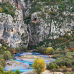
Rare species of plants can be found within the gorge of Brontari near Portitsa (Mitropoli region), a 300 metres long canyon two kilometres from the village, accessible by the forest road that goes from Portitsa towards Agios Giorgios. The woods of Kiri spread above the village itself. The view from the limestone peak of Bombirotripa, at an elevation of 762 metres, overlooks the plains of Thessaly and is enchanting. The peak is also the site of well-preserved walls of an ancient acropolis. Another lovely view can be seen from the top of the hill of Profitis Elias. At the area called Alonia, a stone-paved footpath of a kilometre in length leads to the centre of the village.
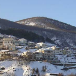
Messenikolas is a village within the Plastiras municipality, 22 kilometres from Karditsa and only two from Morfovouni. The village lies in a natural amphitheatre at an altitude of 700 metres. The waters of the streams of Gravra and Aposkitis flow through the area, complete with rushing fountains and springs. Of the many peaks surrounding the village, Taxiarchis-Zabataka with an altitude of 1,000 metres is known for its abundant vegetation that includes the rare endemic species Messenicoliana Kentavria.
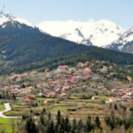
Krioneri is a village sited on the beautiful plateau of Nevropoli next to Lake Plastira. It lies within the forest and is known for its fertile fields, lush vegetation, and remarkable abundance of water. Krioneri lies at an altitude of 835 metres. The Valtorema and Krioneritiko rivers flow through the village district: the Krioneritiko is five kilometres in length. The natural springs and stone-built fountains of Kria Vrissi, Klouvio Nero, Kerassoula, Itia, Gidomantria, and Kastanoula are accessible by unpaved roads and footpaths. The woods of Krioneri include fir, oak, chestnuts and shrub cedars. The peak of Tsougri at 1,600 metres altitude has a shelter left from the rebels of the Greek Civil War. Other viewpoints in the village district include Alonia, Rahi near Lake Plastira, and Saint Georgios at the location of the Monastery within the woods.
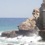
The remains of Ancient Kasthanea (or Kasthanaia) near Keramidi have revealed remains of a city who according to Herodotus was involved in defeating the Persian King Xerxes in 480 BC. Only parts of the walls of this city still remain today.
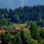
Neohori is a village spread on the hill slopes above Lake Plastira at an altitude of 900-1050 metres. Birds make up a wonderful part of the natural environment and native species include the redneck, wild canary, and the wood thrush. Foxes and wolves are still present in the area. The old village school has been redesigned to serve as the Centre for Environmental Education, Research, and Information and maintains an up-to-date environmental database,while managing natural resources and helping protect the ecosystem of the area.
The Botanical Gardens of Neohori are open daily and welcome visitors to enjoy the brush covered ecosystem of the region, as well as a tree nursery containing linden trees, firs, water plants, herbs and ornamental plants. There is an unexplored cave at Neohori named Drakotripa (Dragon Hole). A wonderful view towards the Plain of Thessaly and region can be enjoyed from the visitor's hostels of the village.
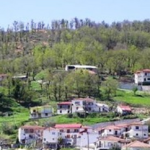
Vatsounia is ten kilometres from the centre of Mouzaki at an altitude of 430 meters. The village has its own special natural beauty and is sparsely populated. The area is thickly forested by chestnut, fir and oak trees. Chemical analyses demonstrate that the fresh waters of Vatsounia are among the purest in Greece. There are three local springs, but only one, the Sklithro Spring, is easily accessible by footpath.
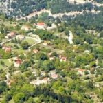
Leontito is a village in the Athamanon Community which is literally surrounded by fir forest and fruit trees at an altitude of 1,000 metres. The Kriorema or Leontitis River flows through from the ranges of Delidimi and into the Acheloos, complete with trout-filled waters. The peak of Delidimi is 2,163 metres in altitude. From the peak of Tsournata, at an altitude of 2,163 metres, a stunning view extends toward Arta. Wildlife in the area includes hares, wild sheep, goats, and deer. Leontito boasts the following forests: Megalakos with firs and soft cedars, Profitis Ilias with firs, cedars and oaks, Agia Triada (Holy Trinity) forest with firs, cedars, shrub oak, and Agios Konstantinos with firs and cedars. There are also two caves in the region.
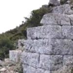
Ancient Eretria was founded on a hill some 650 meters high in the middle of the great Thessalian plain, not far from today's village of Palaiomylos. You'll find few remains of an acropolis, walls and gates on the site. Source: Farsala.gr
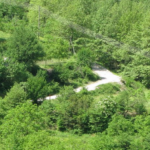
Marathos village within the Acheloos is at an altitude of 640 metres. The Acheloos River crosses Marathos, while several fresh water springs such as the Birta, Dihali, Tsiongari contribute to the beauty and drinking water of the area. The woods include fir, plane trees, and shrub oak. Caves are found at Kapsali and Marathos. At an altitude of 1,100 metres on Krania Peak, an exceptional view extends towards the Acheloos River and Spilia. On the top of fir-forested Mt. Stithos at an altitude of 1000 metres, there is also an excellent view of the Tsoumberikos Mountains and the Acheloos River. The peak of Mount Dol, at 1400 meters looks towards the Pindos mountain range.